Of the Town of Windsor and the Little Park
(from the Harl. MSS No. 3749)
© WLHG
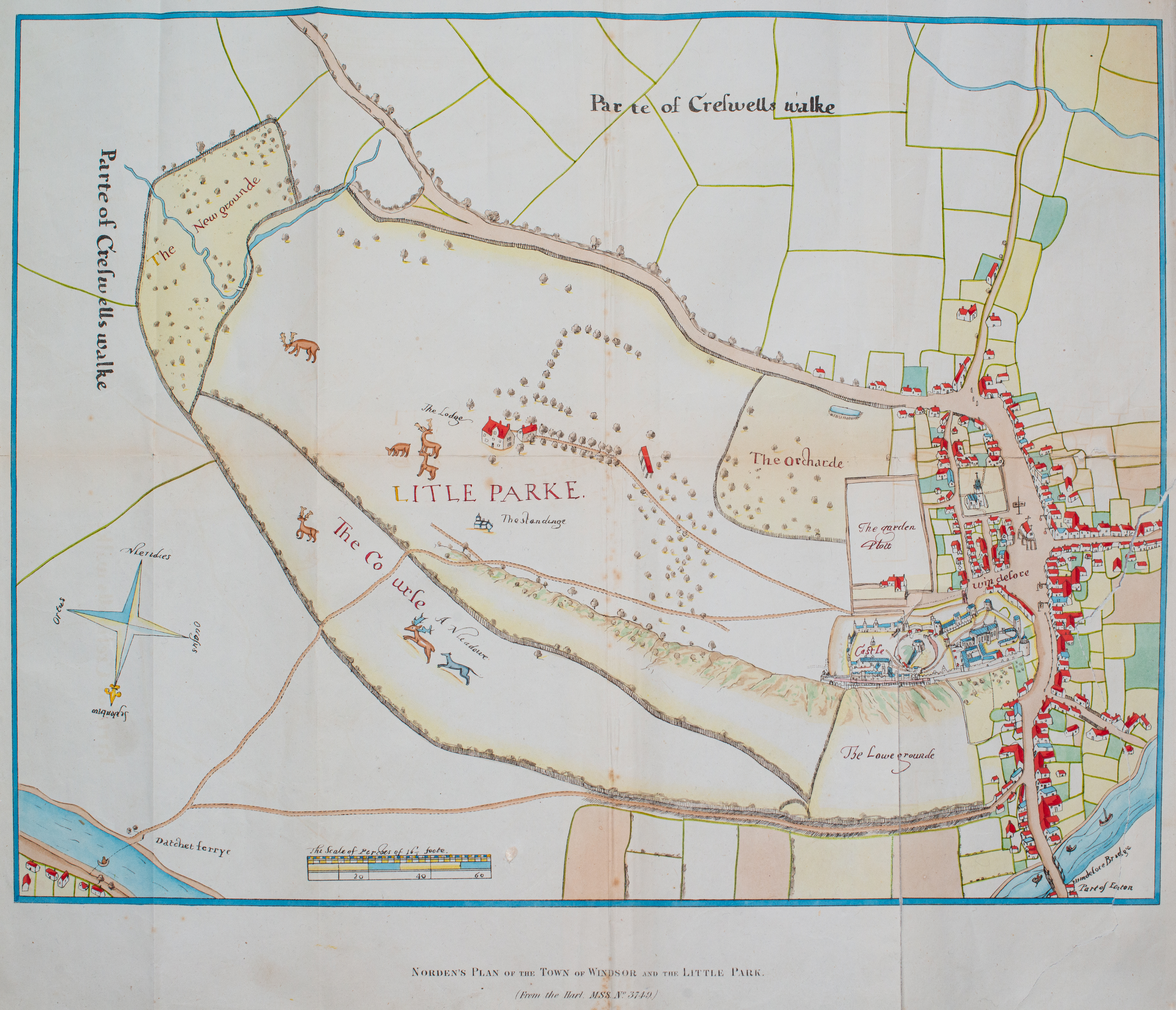
The map shows streets and a few buildings that are still there today. From the Windsor Bridge across the River Thames, up Thames Street into the High Street (with The Guildhall) and then splitting into Park Street (now shortened) and Sheet Street heading south. Peasod Street heads ESE from The Guildhall and you can see the road eastward to Datchet (and its ferry).
John Norden (c1754 – 1625) was a renowned cartographer/topographer who was appointed as surveyor of the royal woods and forests of Berkshire in 1600. In 1607 he created the Description of the Honour of Windsor (Harl. MSS. 3749) dedicated to James I. This colourful and detailed map may have been part of that collection. Many of his works can be found in the Royal Collection Trust and a similar work, A Description of the Honor of Windesor, can be found on line (reference RCIN 1142252).
